
Where Did Israel Cross the Red Sea? Examining the Major Exodus Crossing Theories
From the marshes of the eastern Delta to the Gulf of Suez and the deep waters of Aqaba, several locations have been proposed for one of the Bible’s most dramatic events.
Few scenes in Scripture are as vivid as Israel standing at the edge of the sea with Pharaoh’s army closing in behind them. Exodus describes Moses stretching out his hand, a strong east wind driving the water back through the night, Israel passing through on dry ground, and the sea returning over the Egyptian force. Yet for all the detail in the story, one question has remained surprisingly difficult to answer: where exactly did it happen?
The biblical itinerary gives us names including Rameses, Succoth, Etham, Pi-hahiroth, Migdol, Baal-zephon, and the Yam Suph. The problem is that several of those locations remain uncertain, and the landscape between the eastern Nile Delta and Sinai has changed considerably over time. Lakes have shifted, canals have been cut, marshes have dried, and the modern Suez Canal now runs through terrain that looked very different in the ancient world.
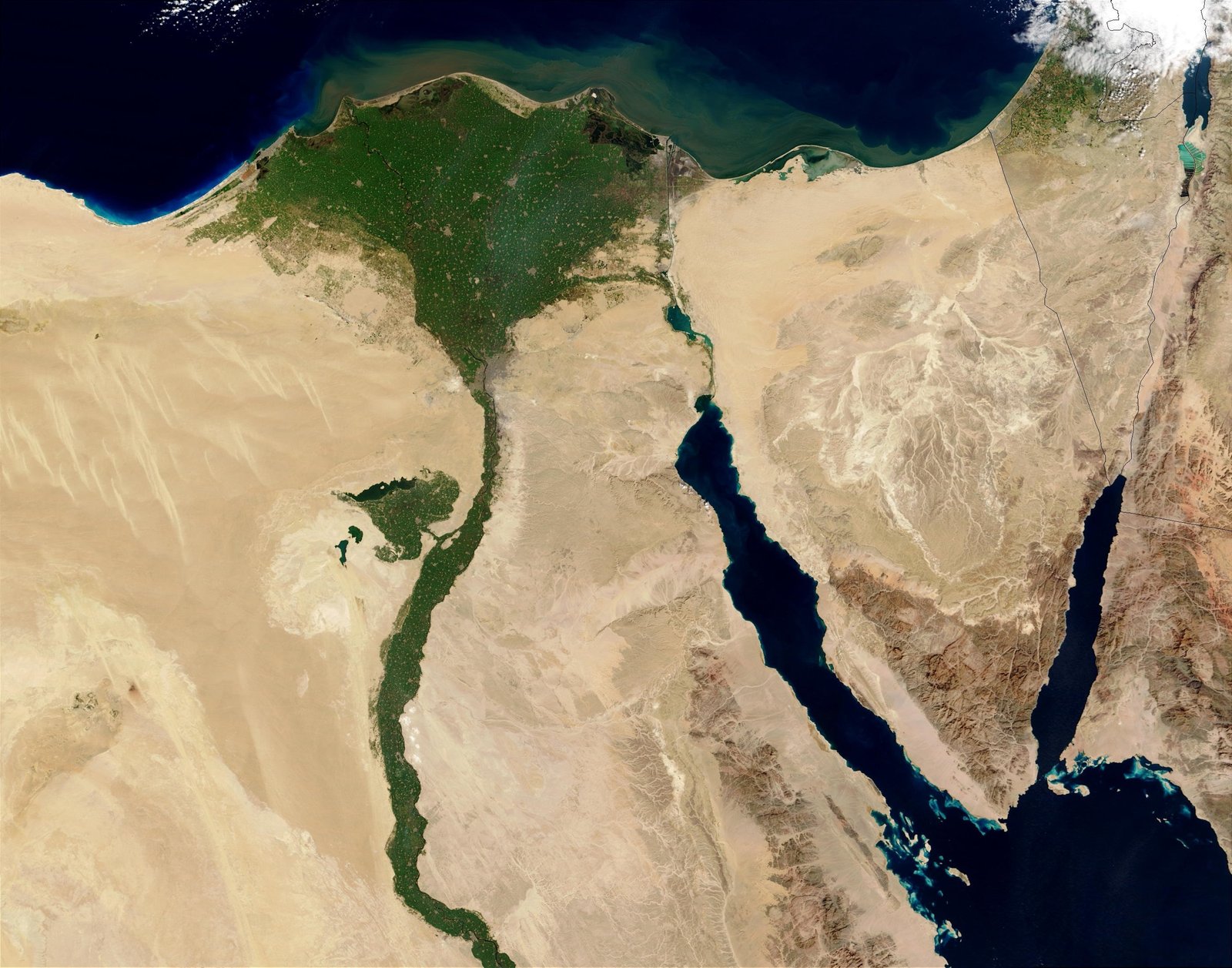
That uncertainty has produced several major theories. Some place the crossing in the northern lake and marsh system. Others favor the Bitter Lakes or Lake Timsah. A long-standing traditional view puts the event near the northern end of the Gulf of Suez. More recently, the Gulf of Aqaba, especially Nuweiba, has gained a devoted following. Each proposal solves certain problems while creating others.
The First Question: What Does Yam Suph Mean?
Much of the debate begins with the Hebrew name Yam Suph. It has traditionally been rendered “Red Sea,” following the ancient Greek translation, but many modern scholars translate it “Sea of Reeds.” That has encouraged a search for reed-filled lakes or marshes north of the Gulf of Suez rather than the open saltwater gulf itself.
There is an important complication, however. Elsewhere in Scripture Yam Suph is clearly associated with waters at the Gulf of Aqaba. First Kings 9:26, for example, places Ezion-geber beside Yam Suph near Elath. That means the biblical term cannot simply be reduced to “a marsh with reeds.” It appears capable of functioning as a broader geographical name connected with the Red Sea system. Barry Beitzel has argued strongly for this wider ancient geographical usage, while James Hoffmeier has defended a more northerly Reed Sea identification based on Egyptian geography and the eastern frontier.
So even before plotting a route on a map, the name itself leaves room for debate.
The Northern Lakes and Ballah Region
One influential modern reconstruction places the crossing much farther north, in the network of lakes, lagoons, canals, and marshlands that once formed a watery barrier between the eastern Delta and northern Sinai. Hoffmeier’s work has focused particular attention on the Ballah region and Egypt’s New Kingdom frontier system.
The attraction of this view is geography. The Israelites depart from Rameses, move toward Succoth and Etham, and are then told to turn back and camp near Migdol and the sea. Egyptian texts show that the northeastern frontier contained forts, waterways, and places whose names may illuminate the biblical itinerary. A northern crossing also keeps the early Exodus route relatively close to the Delta rather than requiring Israel to travel a considerable distance south before Pharaoh overtakes them.
The weakness is that the identification depends heavily on reconstructing an ancient landscape that no longer exists. The exact locations of Pi-hahiroth and Baal-zephon remain uncertain, and proposed matches for Migdol are debated. A northern lake crossing may fit the phrase “Sea of Reeds” naturally, but critics question whether such a location best matches the biblical use of Yam Suph elsewhere or the scale of the event described in Exodus 14 and 15.
Lake Timsah and the Bitter Lakes
A related family of theories moves the crossing somewhat southward to Lake Timsah or the Bitter Lakes. Older scholars often imagined that the head of the Gulf of Suez extended farther north in antiquity, perhaps linking more directly with these lakes. Others do not require a continuous gulf but still locate the crossing somewhere within this central isthmus water system.
This model has several practical strengths. It lies along the natural corridor between the Delta and Sinai, it offers bodies of water large enough to form a serious obstacle, and it works reasonably well with a route through Wadi Tumilat. It also gives the east wind of Exodus 14 a plausible geographical setting in which water could be driven away from a shallow basin while still affirming the divine timing and miraculous deliverance described by the text.
That corridor remains archaeologically important. A recently announced Hyksos-era settlement at Tell el-Ku’a in Wadi Tumilat adds new evidence for settlement, storage, and movement through this eastern-Delta landscape.
The difficulty is again historical geography. Arguments that the Gulf itself extended far north have been challenged, and modern geological and archaeological work has complicated older reconstructions. The biblical place names do not settle the matter, and a crossing at one particular lake can easily become dependent on a chain of uncertain identifications.
The Traditional Gulf of Suez Crossing
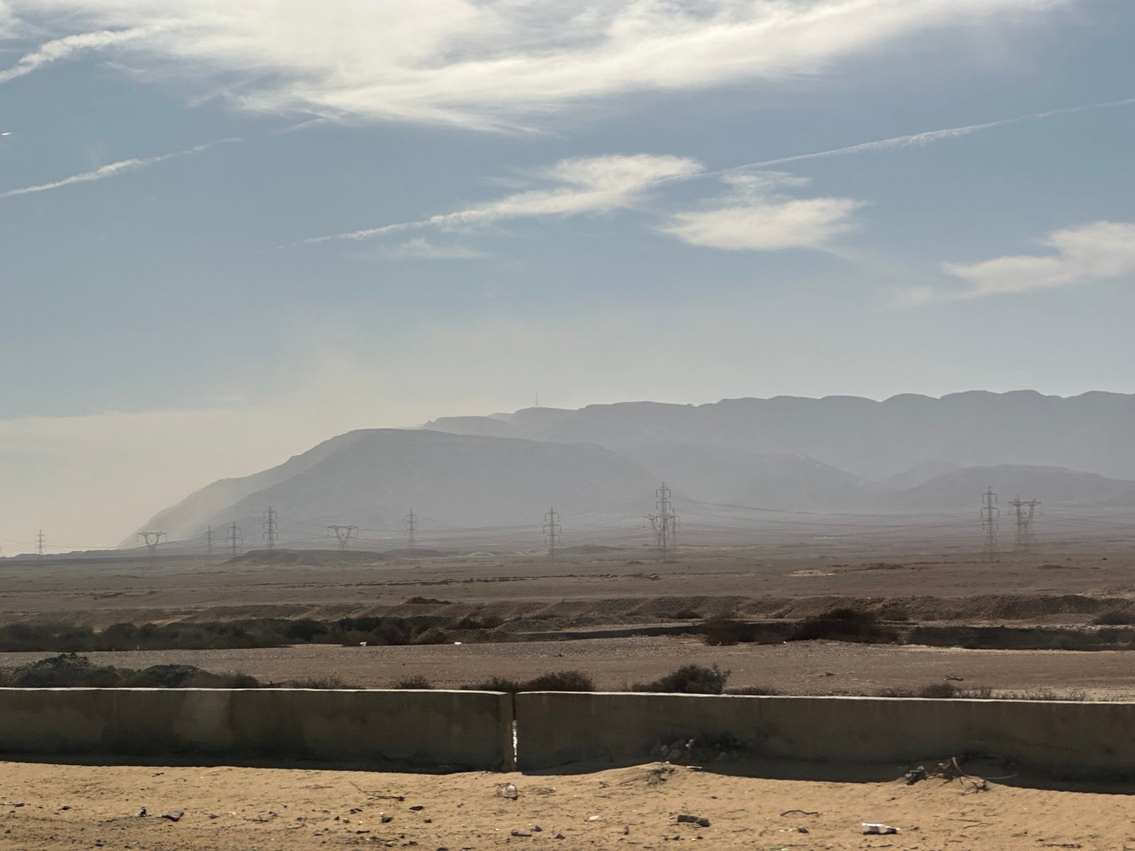
For centuries, many interpreters placed the crossing at or near the northern end of the Gulf of Suez. Some proposals put it just north of modern Suez. Others move it a few miles south, toward a broader coastal plain and shallower approaches to the gulf. This is the location that became familiar in traditional Bible maps and, much later, in popular portrayals of the Exodus.
The chief strength of the Suez view is that it takes the traditional identification of the sea seriously and places the crossing at an unmistakable arm of the Red Sea. It also offers a dramatic geographical setting in which Israel could be trapped between water, desert, and the approaching Egyptian army. The mountains around the western side of the Gulf of Suez add weight to Pharaoh’s statement that the Israelites were “entangled in the land.”
There are problems. Scholars favoring the northern route argue that the place names in Exodus fit the eastern Delta frontier better than the Suez region. The travel distance from the Delta also becomes greater. And because Pi-hahiroth, Migdol, and Baal-zephon have not been securely identified near Suez, the traditional view cannot simply point to a known ancient marker and declare the case closed.
Still, the Suez proposal has remained remarkably durable. Recent work by Beitzel has renewed the argument that the traditional Red Sea geography deserves more attention than it sometimes receives in modern discussions.
The Gulf of Aqaba and Nuweiba
The most popular alternative in recent decades places the crossing not on the western side of Sinai at all, but on the eastern side, across the Gulf of Aqaba. The best-known version identifies the broad beach at Nuweiba as the Israelite encampment and proposes a crossing eastward toward the Arabian shore.
Supporters point to the dramatic physical setting. Nuweiba opens onto a large beach surrounded by rugged mountains, creating the visual impression of a people boxed in with nowhere to go. The Gulf of Aqaba is unquestionably part of the biblical Yam Suph geography in later passages. Proponents also argue that a crossing into Arabia may fit passages describing Moses in Midian and statements that have been interpreted as locating Sinai in Arabia.
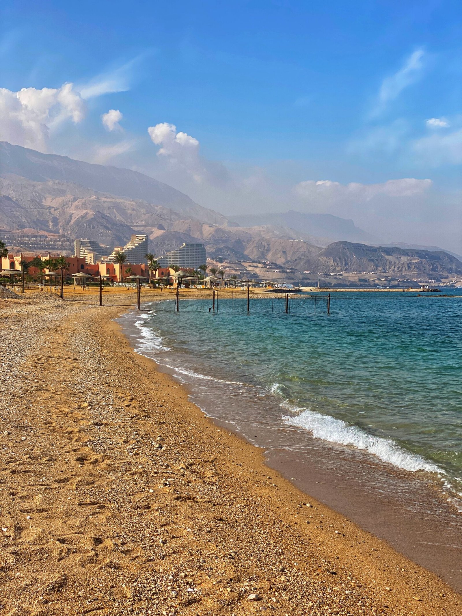
The biggest challenge is distance. An Aqaba crossing requires the Israelites to travel across most of the Sinai Peninsula before the sea crossing, even though the narrative places the confrontation with Pharaoh relatively early in the journey. Critics also point to the extreme depth of the Gulf of Aqaba. At Nuweiba the proposed route crosses very deep water, meaning the miracle would have involved an extraordinary vertical displacement of water and a long descent and ascent across the seabed. That is certainly not impossible within a miraculous reading of Exodus, but it means the often-repeated idea of a convenient shallow “land bridge” should be treated cautiously.
Claims that chariot wheels, coral-encrusted artifacts, or other Egyptian remains have been found on the seabed have circulated widely, but they have not been documented through controlled archaeological investigation in a way that can presently carry the argument.
The Straits of Tiran
A less common southeastern proposal places the crossing even farther south at the Straits of Tiran, where the Gulf of Aqaba opens into the Red Sea. Advocates point to shallower areas and islands near the straits and argue that the route may offer a more manageable seabed than Nuweiba.
The price is an even longer journey before the crossing. Israel would need to travel deep into southern Sinai while Pharaoh’s pursuit is still unfolding. For many readers, that stretches the sequence of Exodus 12–14 too far. Yet the proposal remains part of the wider discussion because it takes seriously both the Red Sea terminology and the geography of the southern peninsula.
What the Evidence Can and Cannot Tell Us
One reason this debate continues is that the text gives us enough information to ask geographical questions, but not enough to identify the crossing point with certainty. Rameses and the eastern Delta provide a reasonable starting region. Succoth is often connected with Wadi Tumilat. Beyond that, the confidence level drops. Migdol is a descriptive name that could apply to more than one fortified tower. Pi-hahiroth remains uncertain. Baal-zephon was a divine name that could have been attached to more than one sanctuary.
Archaeology can reconstruct Egyptian frontier systems, ancient settlement patterns, and the changing waterways of the isthmus. Bathymetry can tell us how deep Aqaba is. Historical geography can show how ancient writers used the term Red Sea. What archaeology has not yet given us is a sign saying, “Israel crossed here.”
That is not a weakness in the biblical account. It is simply the reality of trying to locate a mobile event more than three millennia later in a landscape that has changed dramatically.
So Where Do I Think It Happened?
If you asked me for my favorite, I would still lean toward a crossing at or near the northern tip of the Gulf of Suez, close to the traditional location. I think the wider biblical use of Yam Suph, the long history of the Suez identification, and the geography of the northern gulf keep that option very much alive. I also like the way the terrain around Suez can make sense of a people who suddenly appeared trapped between the sea, the wilderness, and Pharaoh’s army.
But I would not write the location onto the map in permanent ink. The northern lake models deserve serious attention, especially where they draw on Egyptian frontier archaeology. The Bitter Lakes and Timsah proposals solve some itinerary problems. Aqaba forces us to wrestle with passages that identify Yam Suph on the eastern side of Sinai. Every proposal has something worth considering, and every proposal has questions it still needs to answer.
That is part of what makes this such a good question to investigate for yourself. Read Exodus 12–15 and Numbers 33 with a map open. Trace the proposed routes. Look at the distances. Study the ancient waterways. Ask where the place names fit best, and where each theory begins relying on assumptions rather than evidence.
Then tell me what you think. Which crossing site do you favor, and why? I would genuinely love to hear your case in the comments below.

Research Sources and Further Reading
Primary biblical passages: Exodus 12–15 and Numbers 33 (ESV). Scripture is cited in the text rather than treated as a bibliography entry.
- Beitzel, Barry J. Where Was the Biblical Red Sea? Examining the Ancient Evidence. Lexham Press, 2020. Google Books. A detailed defense of traditional Red Sea geography and critique of alternative identifications.
- Bible Gateway. “Red Sea.” Encyclopedia of the Bible. Online reference. An overview of Yam Suph terminology and proposed northern lake geography.
- Byers, Gary A. “New Evidence from Egypt on the Location of the Exodus Sea Crossing, Part 1.” Bible and Spade 19, no. 1 (Winter 2006): 14–22. Online text. Presents the northern Ballah-region case and related eastern-Delta evidence.
- Fritz, Glen A. The Lost Sea of the Exodus: A Modern Geographical Analysis. 2nd ed. GeoTech, 2016. Author synopsis. A representative modern argument for an Aqaba crossing and Nuweiba.
- Hoffmeier, James K. “The Location of the Re(e)d Sea.” In Ancient Israel in Sinai: The Evidence for the Authenticity of the Wilderness Traditions, 75–110. Oxford University Press, 2005. Oxford Academic. A major archaeological and geographical study of Egypt’s eastern frontier and the northern Reed Sea model.

Nate Loper
Hi there.